In today’s fast-paced world, reliable navigation apps have become indispensable tools for anyone on the move. Whether you’re commuting to work, exploring a new city, or embarking on an adventurous road trip, having a trustworthy navigation app on your Android device can make all the difference. These apps guide you to your destination with turn-by-turn directions and provide real-time traffic updates, alternative routes, and many other features to ensure a smooth and stress-free journey.
As we enter 2024, the landscape of navigation apps has evolved significantly, with innovations and improvements enhancing user experience. From advanced AI-driven suggestions to offline capabilities that ensure you’re never lost even without a data connection, the latest navigation apps offer a comprehensive suite of tools designed to cater to every traveler’s needs. In this article, we will explore the best navigation apps available for Android in 2024, highlighting their key features, pros, and cons, to help you make an informed choice for your next trip.
Don’t Miss: Best Battery Saver Apps
Top Features to Look for in Navigation Apps
When choosing a navigation app for your Android device, it’s important to consider the features that will enhance your travel experience and ensure you reach your destination efficiently and safely. Here are some top features to look for:
Real-Time Traffic Updates
One of the most valuable features in a navigation app is the ability to provide real-time traffic updates. This functionality helps you avoid traffic jams, road closures, and accidents by suggesting alternative routes, ensuring you reach your destination as quickly as possible. Apps like Google Maps and Waze are well-known for their accurate and timely traffic information.
Offline Maps
Having access to offline maps is crucial, especially when traveling in areas with poor or no internet connectivity. Offline maps allow you to download specific regions or entire countries in advance, so you can navigate without relying on a mobile data connection. This feature is particularly useful for international travel, where data roaming charges can be expensive.
Voice-Guided Navigation
Voice-guided navigation provides turn-by-turn directions through voice prompts, allowing you to keep your eyes on the road and hands on the wheel. This feature enhances safety and convenience, making it easier to follow complex routes without constantly checking your phone’s screen.
Multi-Stop Routing
For users who need to make multiple stops along their journey, multi-stop routing is an essential feature. It enables you to plan a route with several destinations, optimizing the order of stops for the most efficient path. This is particularly useful for delivery drivers, sales representatives, or anyone running multiple errands.
Integration with Other Services
Modern navigation apps often integrate with other services and apps to provide a seamless travel experience. For instance, integration with calendar apps can automatically pull in event locations and plan routes accordingly. Some apps also integrate with ride-sharing services, public transit schedules, and points of interest like restaurants, gas stations, and hotels.
These key features ensure that you have a reliable and efficient navigation experience, tailored to your specific needs and preferences. When evaluating navigation apps, consider which features are most important to you and how they can enhance your travel experience.
Best Navigation & Map Apps for Android
Here’s a detailed overview of some of the best navigation apps for Android in 2024, highlighting their key features, pros, and cons:
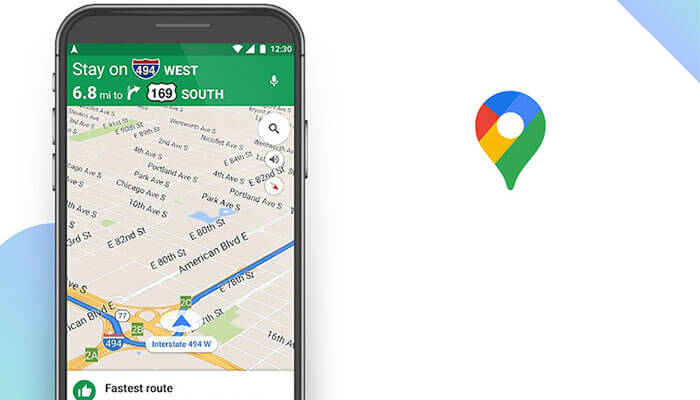
1. Google Maps
Key Features:
- Real-time Traffic: Provides live traffic conditions and suggests alternative routes.
- Offline Maps: Download maps for offline use, including turn-by-turn navigation.
- Integration: Seamlessly integrates with Google services like Google Assistant and Google Calendar.
- Street View: Offers panoramic street-level views of destinations.
- Public Transit: Includes public transit schedules and routes for many cities worldwide.
Pros:
- Widely used and trusted for accurate navigation.
- Regular updates and improvements.
- Excellent integration with other Google services.
Cons:
- Requires a Google account for full functionality.
- Some advanced features may require a data connection.
2. Waze
Key Features:
- Crowdsourced Data: Relies on user-generated reports for real-time traffic updates.
- Community Features: Allows users to report accidents, hazards, and police traps.
- Voice-guided Navigation: Provides turn-by-turn directions with voice prompts.
- Social Integration: Connects with friends and allows coordination on routes.
Pros:
- Exceptional for real-time traffic updates and rerouting.
- Engaging community-driven platform.
- Alerts for speed cameras and police presence.
Cons:
- Heavily relies on internet connectivity.
- May not have as extensive offline features compared to other apps.
3. Sygic GPS Navigation & Maps
Key Features:
- Offline Maps: Offers high-quality offline maps for navigation without the internet.
- Voice-guided Navigation: Provides clear turn-by-turn directions with spoken street names.
- Car Connectivity: Supports Android Auto integration.
- Live Traffic Updates: Provides real-time traffic information.
Pros:
- Excellent offline capabilities.
- Premium features like lane guidance and speed limit warnings.
- Lifetime map updates are available with the premium version.
Cons:
- Some advanced features are behind a paywall.
- The interface can be less intuitive compared to other apps.
4. HERE WeGo
Key Features:
- Offline Maps: Download maps for offline use, including navigation and public transit.
- Public Transit: Provides schedules and routes for buses, trains, and subways.
- Voice-guided Navigation: Offers turn-by-turn directions with voice prompts.
- Live Traffic: Real-time traffic updates and alternative route suggestions.
Pros:
- Strong offline capabilities with detailed maps.
- Integrates public transit options seamlessly.
- Offers walking and cycling routes.
Cons:
- UI can be complex for new users.
- Traffic data may not be as comprehensive in some regions.
5. MapQuest
Key Features:
- Voice-guided Navigation: Provides turn-by-turn directions with voice prompts.
- Live Traffic Updates: Real-time traffic information and alternative routes.
- Offline Maps: Offers limited offline capabilities for basic navigation.
Pros:
- Simple interface.
- Free to use with basic features.
Cons:
- Offline functionality is limited compared to other apps.
- Not as frequently updated as some competitors.
6. OsmAnd
Key Features:
- OpenStreetMap Data: Uses crowd-sourced OpenStreetMap data for maps and navigation.
- Offline Maps: Download maps for offline use, including detailed hiking and biking trails.
- Navigation Features: Offers lane guidance, speed limit warnings, and voice-guided navigation.
Pros:
- Extensive offline capabilities with detailed maps.
- Great for outdoor activities like hiking and biking.
- Free version is available with basic features.
Cons:
- The user interface can be overwhelming.
- Less intuitive for casual users compared to mainstream apps.
7. Komoot
Key Features:
- Outdoor Navigation: Specializes in hiking, cycling, and mountain biking routes.
- Offline Maps: Download detailed maps for offline use.
- Route Planning: Plan routes based on fitness level and terrain.
Pros:
- Excellent for outdoor enthusiasts.
- Provides detailed information on trail difficulty and elevation.
Cons:
- Primarily focused on outdoor activities, less suitable for urban navigation.
- Subscription is required for full offline access and premium features.
8. Polaris GPS Navigation
Key Features:
- Offline Maps: Download maps for offline use, including topographic maps.
- Tracking: Record and share tracks, waypoints, and routes.
- Navigation Tools: Includes compass, speedometer, and altimeter.
Pros:
- Strong offline capabilities, including topographic maps.
- Comprehensive navigation tools for outdoor activities.
Cons:
- UI can be dated and less intuitive.
- Limited integration with other services compared to mainstream apps.
9. Scout GPS Navigation
Key Features:
- Voice-guided navigation.
- Real-time traffic updates.
- Parking suggestions and availability.
- Fuel prices and station locator.
- Commute ETA sharing.
Pros:
- Good for daily commuting and road trips.
- Intuitive interface.
- Integration with major car brands for in-dash use.
Cons:
- Limited international maps and features.
- Traffic data is not as comprehensive as some competitors.
10. Maps.Me
Key Features:
- Offline maps and navigation.
- Points of interest (POI) with reviews.
- Walking directions and hiking trails.
- Bookmark and route sharing.
- Public transport information.
Pros:
- Excellent offline capabilities.
- Detailed POI information.
- Lightweight app with fast performance.
Cons:
- Limited real-time traffic updates.
- Navigation features may not be as advanced as other apps.
These navigation apps cater to various needs from everyday commuting to outdoor adventures, offering a range of features to enhance your travel experience on Android devices in 2024. Choose the one that best fits your navigation preferences, whether you prioritize offline maps, real-time traffic updates, or specific features for hiking or biking.
Specialized Navigation Apps
Specialized navigation apps cater to specific needs beyond basic driving directions, offering tailored features for various modes of transportation or specific activities. Here are some specialized navigation apps for Android in 2024:
1. Transit App
Key Features:
- Real-time public transit schedules and maps.
- Trip planning with multiple route options.
- Offline maps and navigation.
- Transit alerts and delay notifications.
Use Case: Ideal for daily commuters relying on public transportation, offering precise schedules and updates.
2. AllTrails
Key Features:
- Discover hiking, biking, and running trails.
- GPS navigation for outdoor activities.
- Trail reviews and photos from the community.
- Offline maps and trail recording.
Use Case: Perfect for outdoor enthusiasts looking to explore new hiking and biking trails with detailed trail information.
3. Bike Citizens
Key Features:
- Bike-specific navigation and route planning.
- Bicycle-friendly routes with elevation profiles.
- Offline maps and navigation.
- Points of interest for cyclists.
Use Case: Designed for cyclists navigating urban areas or exploring new routes, providing bike-friendly directions and local cycling points of interest.
4. Gaia GPS
Key Features:
- Outdoor GPS navigation and maps.
- Hiking, hunting, and off-road trail maps.
- Offline maps and navigation.
- Detailed topographic maps and overlays.
Use Case: Suited for hikers, hunters, and off-road enthusiasts needing detailed topographic maps and offline navigation capabilities.
5. Calimoto
Key Features:
- Motorcycle navigation and route planning.
- Curvy and scenic route suggestions.
- Offline maps and navigation.
- Community-shared routes and trip logging.
Use Case: Tailored for motorcyclists seeking scenic routes and motorcycle-friendly navigation with offline support.
6. Spyglass
Key Features:
- Augmented reality navigation.
- GPS compass and gyrocompass.
- Offline maps and navigation.
- Celestial navigation and star finder.
Use Case: Unique for users engaged in outdoor activities, sailing, or astronomy, offering advanced navigation tools including augmented reality overlays.
These specialized navigation apps cater to specific user needs, offering enhanced features and capabilities tailored for various activities such as hiking, biking, public transit, and motorcycle touring. Whether you’re navigating city streets, exploring trails, or planning a motorcycle adventure, these apps provide tailored solutions to optimize your travel experience on Android devices in 2024.
Tips and Tricks for Using Map Apps
Navigating with apps can be quite handy, here are some tips and tricks to make the most of your navigation experience:
- Plan with Offline Maps: Before traveling to areas with poor network coverage, download offline maps in advance. This ensures you can navigate even without an internet connection.
- Customize Your Route: Many navigation apps allow you to customize your route preferences. Optimize for the shortest time, avoid highways, or choose scenic routes depending on your preference.
- Use Voice Commands: Utilize voice-guided navigation to keep your hands free and eyes on the road. Most apps support voice commands for destination input and other commands.
- Stay Updated with Real-Time Traffic: Enable real-time traffic updates to receive alerts about accidents, road closures, or heavy traffic. This feature helps in choosing the fastest route.
- Explore Points of Interest: Discover nearby restaurants, gas stations, and attractions using the app’s points of interest (POI) feature. Some apps integrate reviews and ratings to help you choose.
- Sync Across Devices: If available, sync your navigation app across multiple devices. This ensures a seamless transition between your smartphone and in-car navigation systems, if applicable.
- Save Favorite Locations: Save frequently visited locations (home, work, favorite spots) for quick access. This saves time when setting up routes to common destinations.
- Utilize Live Sharing: Some apps allow you to share your real-time location or ETA with friends and family. This is useful for coordinating meet-ups or letting loved ones track your journey.
- Maximize Battery Life: Navigation apps can drain batteries quickly. To conserve battery, lower screen brightness, close unused apps, and consider using a car charger or power bank.
- Keep App Updated: Regularly update your navigation app to ensure you have access to the latest features, maps, and security patches. Updates often improve performance and reliability.
- Explore Offline Features: Beyond maps, some apps offer offline features like weather forecasts, local guides, and emergency contacts. Familiarize yourself with these offline capabilities.
- Report Issues: Participate in the app’s community features by reporting issues such as map inaccuracies or traffic incidents. Your input can improve navigation accuracy for others.
By applying these tips and tricks, you can enhance your navigation app experience, whether you’re navigating daily commutes, exploring new places, or embarking on road trips.
Future Trends For GPS Apps
Looking ahead, several trends are shaping the future of navigation apps, offering exciting possibilities for users:
- AI-Powered Personalization: Navigation apps are increasingly integrating artificial intelligence (AI) to personalize user experiences. AI algorithms analyze historical data, user preferences, and real-time conditions to offer tailored route suggestions, predictions for optimal departure times, and customized alerts.
- Augmented Reality (AR) Navigation: AR is revolutionizing navigation by overlaying digital information onto the real-world environment seen through the smartphone camera. This technology enhances navigation by providing intuitive visual cues, such as arrows and directions directly on the street view, making it easier to follow routes and locate points of interest.
- Enhanced Real-Time Data: Navigation apps are leveraging IoT (Internet of Things) and connected vehicle technologies to gather and utilize real-time data from vehicles, sensors, and infrastructure. This includes live traffic updates, road conditions, parking availability, and even vehicle-to-vehicle communication for enhanced safety and efficiency.
- Integration with Smart Cities: As cities become smarter, navigation apps are integrating with smart city infrastructure. This includes access to real-time data on public transit schedules, bike-sharing availability, electric vehicle charging stations, and traffic management systems. Integration with city APIs allows for seamless multimodal transportation planning.
- Voice Interaction and Natural Language Processing: Voice-guided navigation is evolving with advanced natural language processing capabilities. Users can interact with navigation apps more naturally, asking questions, making requests, and receiving context-aware responses. This enhances hands-free operation and improves accessibility for all users.
- Environmental and Efficiency Considerations: With growing concerns about environmental impact and fuel efficiency, navigation apps are beginning to offer eco-friendly routing options. These routes prioritize low-emission zones, electric vehicle charging stations, and routes that minimize fuel consumption, promoting sustainable travel choices.
- Expanded Use Cases Beyond Driving: Navigation apps are expanding their capabilities beyond traditional driving scenarios. This includes specialized routing for cyclists, pedestrians, and public transit users, as well as integration with navigation aids for marine and aviation purposes.
- Continuous Improvement in Mapping Accuracy: Mapping accuracy remains a focus, with ongoing improvements in data collection methods, satellite imagery, and crowd-sourced updates. High-definition maps with detailed information on lane markings, road signs, and 3D city models are becoming standard, enhancing navigation precision.
Conclusion
In conclusion, as we navigate through the ever-evolving landscape of navigation apps in 2024, it’s clear that these tools have become integral to our daily lives, offering more than just directions. From real-time traffic updates and personalized route recommendations to advanced features like augmented reality navigation and integration with smart city infrastructure, navigation apps continue to redefine how we explore and navigate our world.
Looking forward, the future of navigation apps holds promise with AI-driven personalization, augmented reality enhancements, and seamless integration with emerging smart technologies. These advancements not only aim to make travel more efficient and convenient but also contribute to safer and more sustainable transportation choices. As users embrace these innovations, navigation apps will undoubtedly continue to shape the way we experience and interact with our surroundings, making every journey smoother and more enjoyable.
FAQs
What is the best navigation app for Android?
The best navigation app often depends on your specific needs. Popular choices include Google Maps for its comprehensive features, Waze for real-time crowd-sourced data, and Sygic for its robust offline capabilities. Choose based on features like real-time traffic updates, offline maps, and integration with other services.
How do navigation apps work?
Navigation apps use GPS technology to pinpoint your location and provide turn-by-turn directions to your destination. They often rely on map data, real-time traffic updates, and sometimes user-generated content to offer the most efficient routes.
Are navigation apps free to use?
Many navigation apps offer basic features for free, such as route planning and turn-by-turn navigation. However, some advanced features like offline maps, traffic alerts, and additional customization may require a subscription or one-time purchase.
Can navigation apps work offline?
Yes, some navigation apps offer offline functionality, allowing you to download maps and navigate without an internet connection. This is particularly useful when traveling in areas with limited or no network coverage.
How accurate are navigation apps?
Navigation apps are generally very accurate, often using high-quality map data and GPS technology. However, accuracy can vary depending on factors such as signal strength, environmental conditions, and the quality of map updates.
Which navigation app uses the least data?
Apps that offer offline maps and navigation typically use less data since they rely less on real-time data streaming. Google Maps and HERE WeGo are known for their efficient data usage when offline maps are downloaded in advance.
Can navigation apps be used for walking or cycling?
Yes, many navigation apps offer modes specifically designed for walking, cycling, and even hiking. These modes consider pedestrian pathways, bike lanes, and trails to provide suitable routes and directions for non-driving activities.
How can I report issues with a navigation app?
Most navigation apps have built-in feedback or reporting features. You can typically report map errors, traffic issues, or other problems directly through the app’s settings or help section. Your feedback helps improve the app’s accuracy and usability.